5 key facts about this project
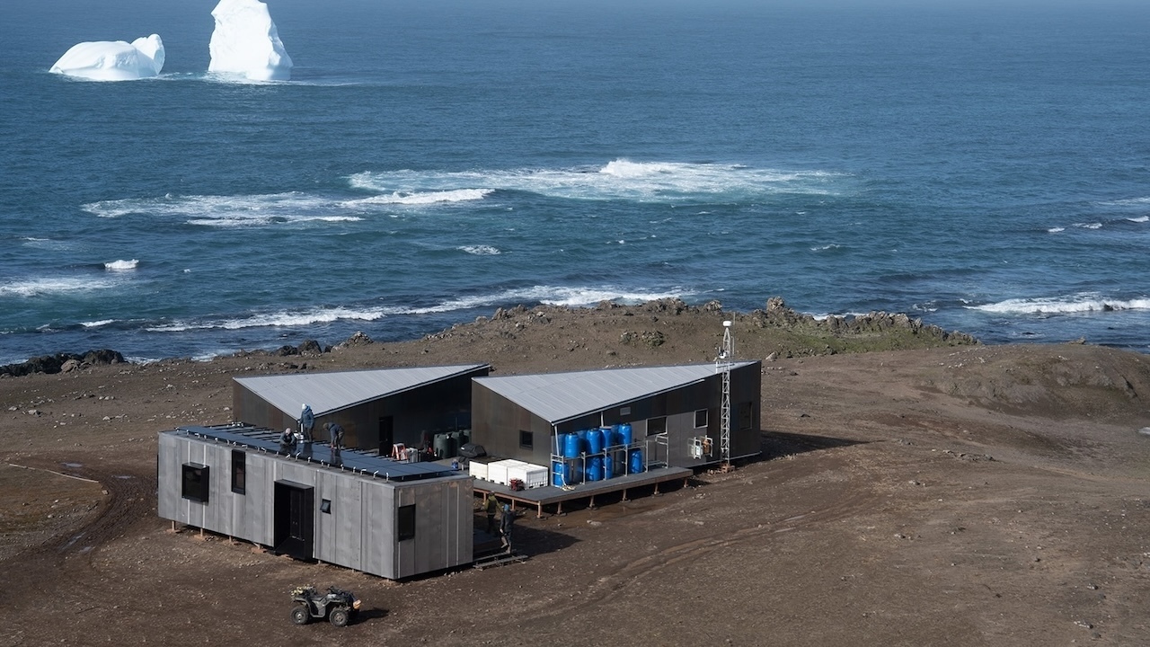
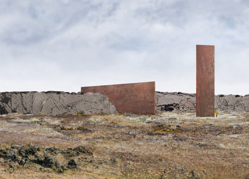
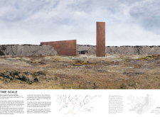
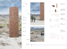
The project explores the relationship between time and landscape in a geological setting, focusing on a fault that opens one centimeter on each side every year. Located in an area influenced by the interactions of the American and Eurasian tectonic plates, the design seeks to create a means of measuring ground movement. The concept connects physical distance with time, encouraging a deeper engagement with the environment through active observation.
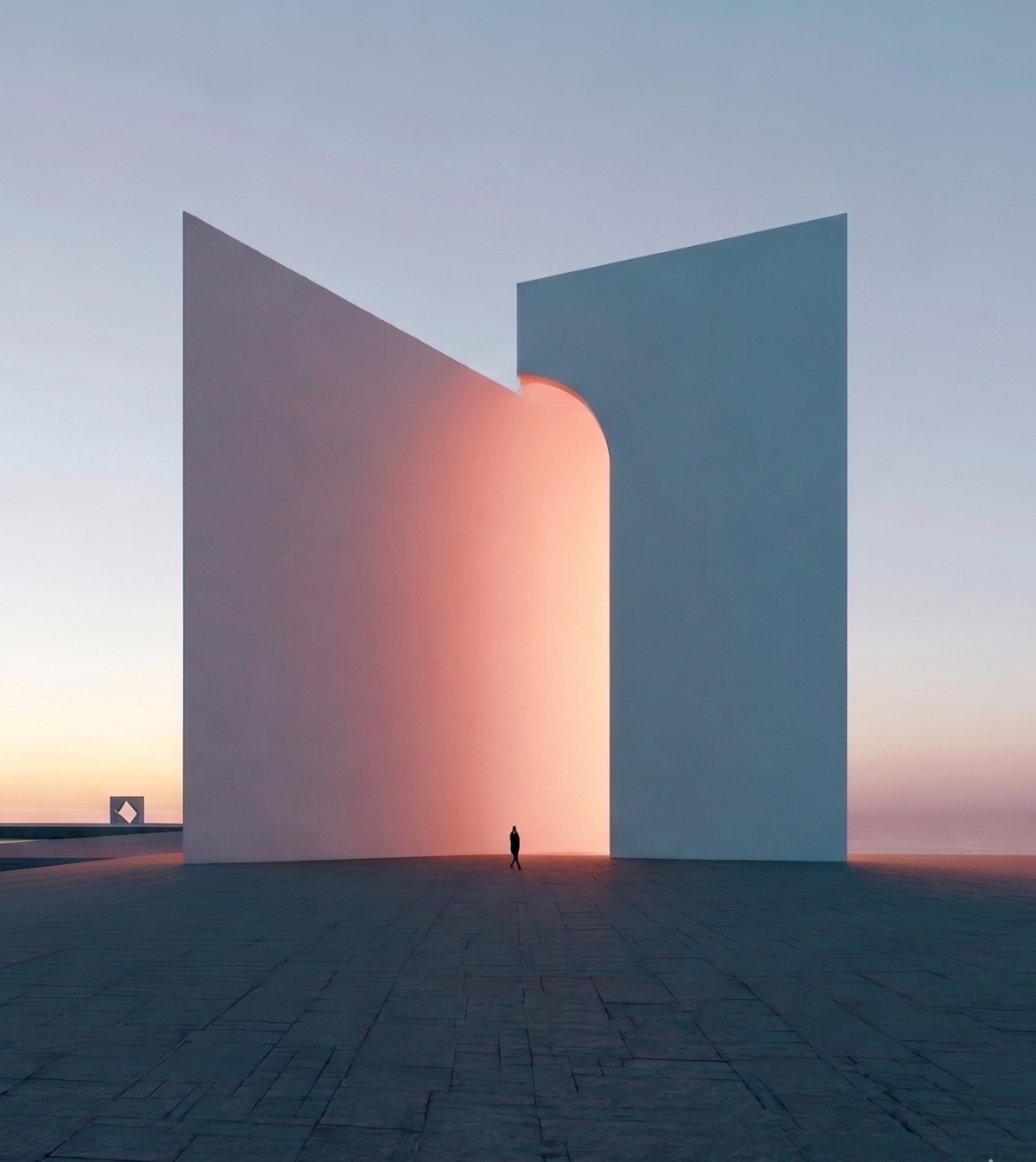
Geometric Expression
A vertical plate facing the fault serves as a key feature of the design. This graduated plate operates like a measuring tool, linking one meter to 100 years. Beacons are placed at specific distances from the fault, marking points in time when viewed from a designated observation area. This layout enables visitors to comprehend the landscape and read the duration of land movement. It effectively merges the ideas of time and space in a tangible manner.
Spatial Dynamics
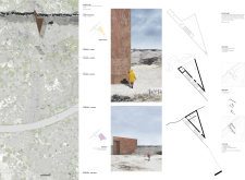
The design incorporates a triangular shape that enhances the observer's connection to the geological changes in the landscape. This triangular structure guides views toward the fault while also allowing wider perspectives from the opposite side. The acute angle creates an interaction with the surroundings, highlighting the importance of context and inviting exploration of different sightlines and experiences within the landscape.
Geological Context
The project relates closely to the geological features of the area, particularly the formations influenced by the Mid-Atlantic Ridge. The fault acts as the origin of the landscape, demonstrating the ongoing geological processes that shape it. As one moves through the site, varying soil ages become apparent, showing how time is interwoven with physical space. This connection enriches the narrative and deepens understanding of the landscape's history.
Visitor Experience
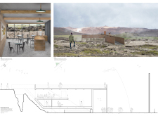
This design functions as an educational tool, offering a continuous route from the ground to the top of the fault. Visitors are drawn into the landscape and encouraged to interact with its geological shifts. The beacons represent distances from the fault, manifesting the idea of movement within the earth. This establishes a virtual line that ties together the experiences of time and space. Every detail enhances comprehension of a living landscape, reflecting its ever-changing nature and inviting people to appreciate the forces shaping their environment.
In this way, the project successfully combines form and function, creating opportunities for exploration and connection with geological time and movement in the landscape.